Discover companies you will love

Mid-career
Use foreign languages
Mid-career
Use foreign languages
Grace
CEO of 株式会社スカイセンス AI for Agriculture
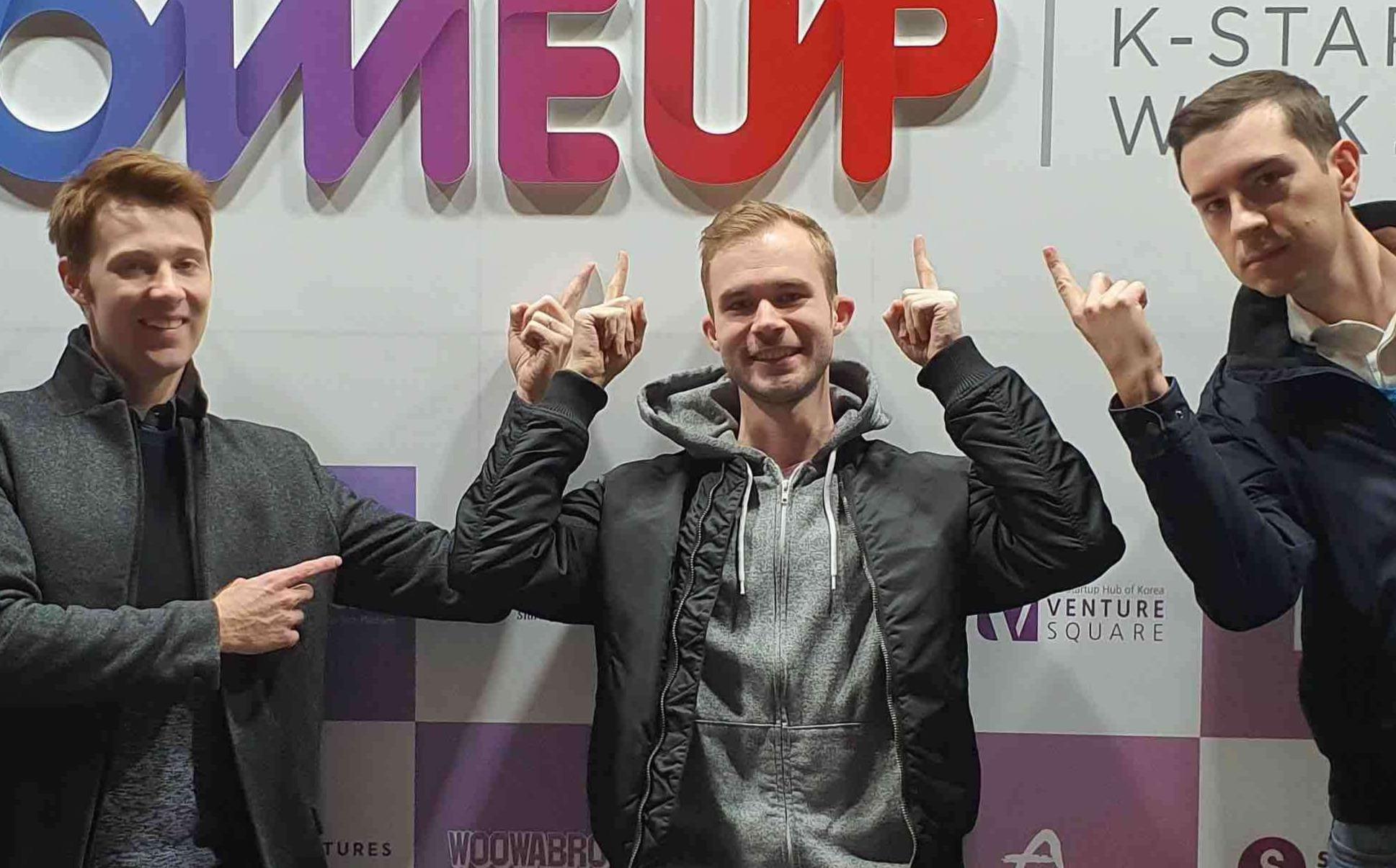
株式会社スカイセンス's members
CEO of 株式会社スカイセンス AI for Agriculture
What we do
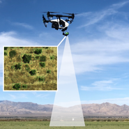
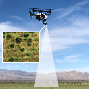
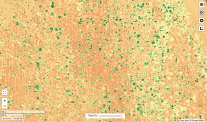
Skysense is a software as a service company that analyzes drone images. We help farming businesses to maximize yield and protect their crops from disease, weeds, and pests. Our expertise is deep learning AI, especially for drone images and Agricultural data.
Some of what we do includes:
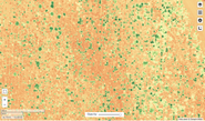
Processing images into interactive maps with critical insights.
Custom R&D for new crops and integrations.
Managing image annotation teams and machine learning models.
Sourcing suitable drones and multispectral cameras.
Teaching customers to easily operate self-flying drones.


What we do

Skysense is a software as a service company that analyzes drone images. We help farming businesses to maximize yield and protect their crops from disease, weeds, and pests. Our expertise is deep learning AI, especially for drone images and Agricultural data.
Some of what we do includes:
Processing images into interactive maps with critical insights.
Custom R&D for new crops and integrations.
Managing image annotation teams and machine learning models.
Sourcing suitable drones and multispectral cameras.
Teaching customers to easily operate self-flying drones.
Why we do
Our company believes empowering farmers by digitally transforming agriculture will positively impact the lives of billions of people. It's a $4 trillion market that employs 1 billion people while feeding every single person and it's the last major frontier that is still fully analog. Farming is the backbone of our society, but farmers face compound risks to their crops and livelihoods every growing season, so we're helping them harness the power of data and AI to prevent those risks.
How we do

Good Work
We do good work because we believe it has meaning and it makes an impact. We don't waste time doing bad work like long emails, excessive meetings, or micromanagement.
Impact
We solve problems that impact society, to change the world and help people’s lives. If you believe in positive change, everyone else can too. Our projects are things we are happy to work on.
Autonomy
People work long hours because they’re passionate not because they have to. We don't micromanage. We set goals without dictating tasks for a high individual level of autonomy.
Fail Frequently
We don’t blame people for mistakes, but rather encourage it because good work requires taking risks. We believe in taking risks by trying many controlled experiments and failing frequently.
Freedom
We have a flat organizational structure with a 4-day work week and we embrace remote work. We don't squander human potential with jobs or offices that people hate.
As a new team member
The role
We aim to digitally transform agriculture, but our product is a work in progress, so we need your help to put it in the hands of customers and communicate their needs to our world class tech team so that we develop the right feature set. We’re looking for sales executives with 10+ years of experience in B2B sales for software or highly experienced Agricultural vendors. You will sell Agricultural software and related products to large clients in Japan in order to solve problems that generally have gone unsolved or require a lot of labor. We’re a very small and dynamic team so you will have to work well with uncertainty, shamelessly fail frequently, and learn quickly to succeed in unchartered territory.
Your day to day
Frequently meet with and communicate with customer leads, including conducting demos.
Initiate and maintain customer relationships with a continuous focus on user hearing.
Communicate customer needs to machine learning scientists and software developers.
Experiment with new customer segments, sales channels, value propositions, and deals.
Write new sales material, improve Japanese translations of content, work on price estimates.
What you bring to the team
Conversational English and native level Japanese -we have a globally diverse team!
Experience selling software, subscriptions, or technology (preferably in Agriculture)
Excels at business development without a playbook for new products and new customers
Experience negotiating and closing large deals, especially when pricing is difficult to set
Takes initiative at lead generation, contacting leads, and developing new sales processes
Can understand complex technologies and communicate their value simply and persuasively
Skilled at sales calls with both inbound and outbound leads
High empathy for customers and ability to narrow down which customer needs to prioritize
Organizational skills for professional account management and strong customer relationships
0 recommendations
0 recommendations
What happens after you apply?
- ApplyClick "Want to Visit"
- Wait for a reply
- Set a date
- Meet up
Job Post Features
Online interviews OK
Company info
Founded on 03/2020
7 members
- Expanding business abroad/
- CEO can code/
- Funded more than $300,000/
Zoom